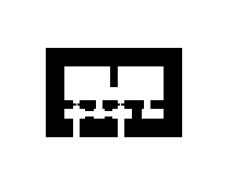
A ruined German military bunker from the Second World War, located in the Normandy region of France. The designation '502a (zerst.)' indicates it was part of the standardized German Atlantic Wall fortification system, with 'zerst.' being an abbreviation for the German word 'zerstört' (destroyed). The site is situated near the commune of Saint-Laurent-sur-Mer, an area that saw intense fighting during the D-Day landings on 6 June 1944. The bunker would have been part of the coastal defenses designed to repel an Allied amphibious invasion.
These types of bunkers, often constructed using the German Regelbau (standardized design) system, typically housed artillery, machine guns, or observation posts. The specific structure at these coordinates is now a concrete ruin, a common fate for many Atlantic Wall positions that were heavily damaged during the battle or systematically demolished after the war. Its location on the Norman coast places it within the historical sector of Omaha Beach, one of the primary American landing zones.
The site serves as a tangible historical relic of the Atlantic Wall, the extensive defensive line built by Nazi Germany along the western coast of Europe between 1940 and 1944. Today, such ruins are frequently visited by military history enthusiasts and tourists exploring the Normandy battlefields. The bunker's preservation state varies, with many structures suffering from decades of coastal weathering and occasional scrap metal recovery. It stands as a silent testament to the massive scale of Germany's coastal fortification efforts and the fierce combat that unfolded in this region.