




Beneath the streets of Helsinki lies one of the world's most extensive and sophisticated underground shelter systems, a vast network carved directly into the city's bedrock. Constructed primarily during the Cold War, this complex was designed as a civil defense measure to protect the entire population of Helsinki from conventional bombing and nuclear attack. The bunkers form an interconnected labyrinth beneath the city center and surrounding areas, representing a monumental engineering feat and a stark symbol of Finland's geopolitical position and preparedness during the tense standoff between superpowers.
The shelters are engineered to withstand significant blasts and radiation, with thick reinforced concrete and rock formations providing protection. They are equipped with independent life support systems, including air filtration, power generation, and water supplies, allowing for prolonged occupation. Their capacity is immense, intended to house a substantial portion of Helsinki's citizens, transforming the underground into a temporary, functional city complete with facilities for sanitation, medical care, and basic living. This infrastructure is a key part of Finland's comprehensive civil defense strategy, which has historically prioritized the protection of its civilian population.
Geographically, Helsinki's location as the capital of a nation sharing a long border with the Soviet Union made such preparations a critical national priority during the Cold War. The bunkers are not a single structure but a distributed system, integrated into the urban landscape beneath government buildings, transport hubs, and residential areas. Today, while maintained for emergency readiness, parts of this vast underground network are also used for non-emergency purposes such as parking, data storage, and cultural tours, offering a unique glimpse into military heritage and urbex exploration of Cold War fortifications.
From Google Maps
Rating: 4.8/5 (8 reviews)
Impressive to see in real life
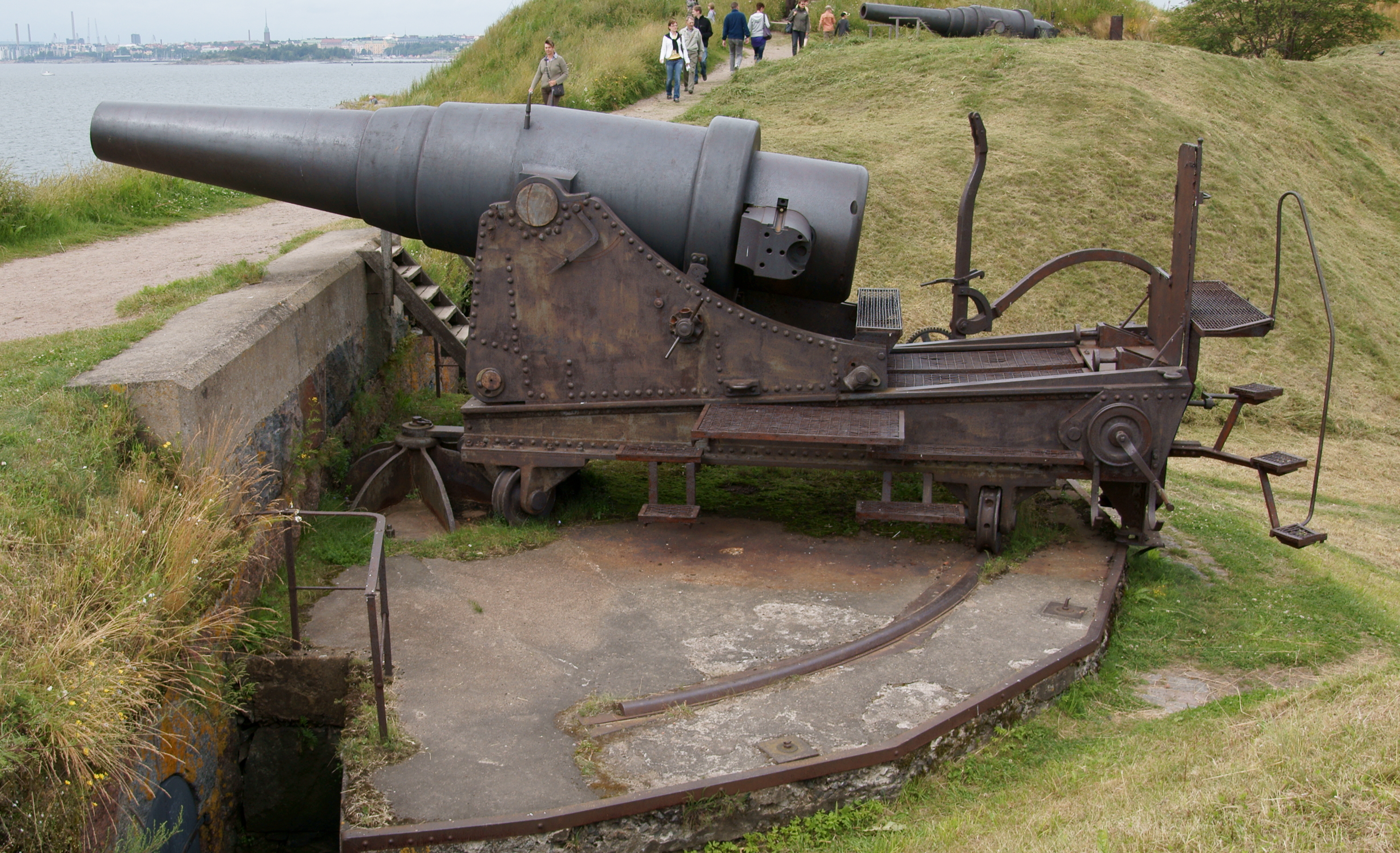
In the Crimean War of 1855, the old Swedish cannons proved to be outdated. They could only shoot 2,000 meters away, while the British cannons could shoot 3,000 meters away. This allowed warships to bombard Suomenlinna from further away. After the war, large earthworks were built and these new steel Russian rifled steel cannons from the late 19th century were brought in, which could shoot almost 20 km away. It would be nice if the technology and use of the cannons were described on information boards. When a child approaches the cannon, it seems that he or she has to climb onto the barrel of the cannon.
Love this! I think places like this are so cool