This bunker model belongs to the Regelbauten program. It was built to the strength level of Constantly(St). The model was originally designed for the army. This model belongs to the use group: Command bunkers.
Specifications
- Concrete Used: 1140 m³
- Baustärke (Build Strength): Type B
Bunkerinfo
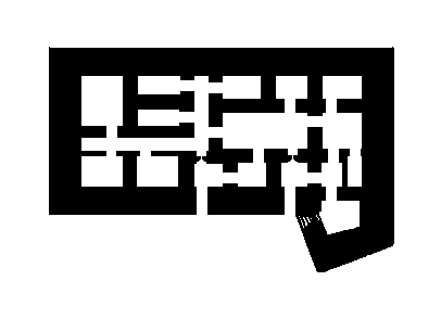
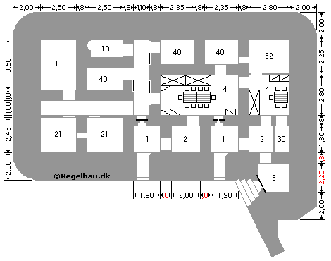
The 117a at Schouwen Duivenland can honestly be called a beautiful bunker. The bunker belonged to W.N.329 and is located in the Slotbos near Burgh Haamstede. This command post, or Regiments Gefechtsstand, is located on a high dune top. And to properly anchor the bunker, it was equipped with a large wing wall. Over the years, however, the sand around the wing wall has disappeared and the bunker has been given the name 'Whale or Wing Bunker'. The bunker has a length of almost 24 meters and a width of almost 14 meters. The location for the construction of the bunker was perfect as a command post because it had an unobstructed view of the command area from this location. Partly because of this, however, it was decided to provide the bunker with an armored steel dome on the roof. A periscope was set up in this dome so that the staff could see for miles. The dome has a thickness of 12 cm and weighs more than 10,000 kilos. The bunker contains 15 rooms for, among other things, close to defense, some rooms for communication, including radio and telephone connections, a command room, etc. Although the bunker is closed, it is certainly worth a visit!
117a Regimental Combat Stand
Construction number: 32091
W.N.329 H (325) - BP.329 - Stp.Schouwen - Burgh Haamstede - Slotbos